




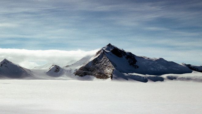
Britain has a new tallest mountain.
Mt
Hope, which is sited in the part of the Antarctic claimed by the UK,
was recently re-measured and found to tower above the previous title
holder, Mt Jackson, by a good 50m (160ft).
Hope is now put at 3,239m (10,626ft); Jackson is 3,184m (10,446ft).
The
map-makers at the British Antarctic Survey (BAS) were prompted to take
another look at the mountains because of concerns for the safety of
pilots flying across the White Continent.
"In Antarctica there
are no roads, so to get around you have to fly planes. And if you're
flying planes you really need to know where the mountains are and how
high they are," explained Dr Peter Fretwell.
"There have been plane crashes on the continent and we believe some of them may have been due to poor mapping."
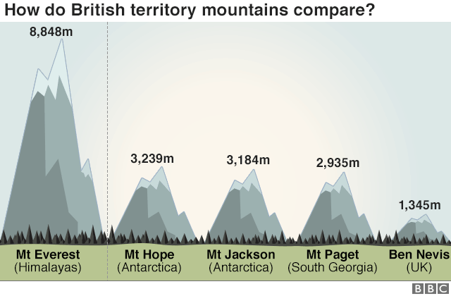
- Mt Paget on South Georgia island is the highest mountain on a British Overseas Territory outside of the Antarctic
- Ben Nevis, the tallest peak within the UK, was recently re-measured using high-precision GPS technology at 1,345m (4,412ft)
As well as giving Mt Hope its new status, the
reassessment has provided a more complete description of the relief
across the quadrant of Antarctica claimed by Britain. This encompasses
the long peninsula that stretches north towards South America.
Some of its mountains have now been "moved" up to 5km to position them more accurately on future maps.
Mount
Vinson, which sits just outside the British Antarctic Territory,
remains the undisputed tallest peak on the continent at 4,892m
(16,049ft).
Dr Fretwell's team is releasing its findings on UN International Mountain Day.
Elevation data-sets are a topic of discussion here at the Fall Meeting of the American Geophysical Union (AGU) - the world's largest annual gathering of Earth and planetary scientists.
The BAS group used a combination of elevation models built from satellite data to make the new mountain assessment.
When
this medium-resolution information threw up the possibility that Mt
Hope had been underestimated, the researchers then ordered in some very
high-resolution photos for confirmation.
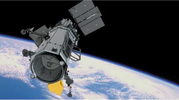
These pictures, taken
from orbit by the American WorldView-2 spacecraft, allowed for a stereo
view of the summits of both Hope and Jackson.
"We call this
photogrammetry," said Dr Fretwell. "Because we know the position of the
satellite so well, if we use it to take two images of a mountain that
are ever so slightly offset from each other, we can then employ simple
trigonometry to work out the height of that mountain."
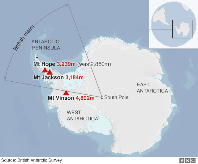
The process raised Hope from 2,860m to 3,239m. The
measurement technique carries an uncertainty of just 5m, so there should
be no argument over the mountain's new-found superiority.
The long chain of peaks that runs down the spine of the Antarctic Peninsula is one of the most spectacular landscapes on Earth.
The
chain was initially built some 50-100 million years ago when an oceanic
tectonic plate slid under the Antarctic continent, said BAS
geophysicist Dr Tom Jordan.
"This produced volcanism and a
shortening and a thickening of the crust. Then, more recently, the ice
sheet and its glaciers have cut deep trenches into the Antarctic
Peninsula, removing rock and depositing it offshore.
"As this
mass has been removed so the whole of the peninsula has rebounded,
uplifting the peaks fairly significantly," he explained.
At the AGU meeting in New Orleans, US researchers are showcasing very similar work - but on a much more extensive scale.
Dr
Paul Morin, from the Polar Geospatial Center at the University of
Minnesota, has led an effort to re-map the elevation of both the Arctic
and the Antarctic.
These projects have access to several years of WorldView images and time on a supercomputer to process all the data.
The Arctic map has an elevation point, or "posting," every 2m across the region. The Antarctic map, due to be released early next year, will have the postings every 8m.
"With
this availability of data, Antarctica has gone from the poorest mapped
place on the planet to one the best," Dr Morin told BBC News. "It makes
better science cheaper and faster to achieve. And it also makes science
much safer because we know where everything is."


.jpg)


No comments:
Post a Comment
Please do not enter any spam link in the comment box.